Using Drones for Engineering: Real-World Benefits, Use Cases and ROI
 By Jerry White
 This article will explain how and why firms use drones for engineering industries. Learn about relevant regulations, the potential for return on investment, industry-specific drone requirements, and more. This information provides credible sources, examples, pictures, and videos.
Introduction

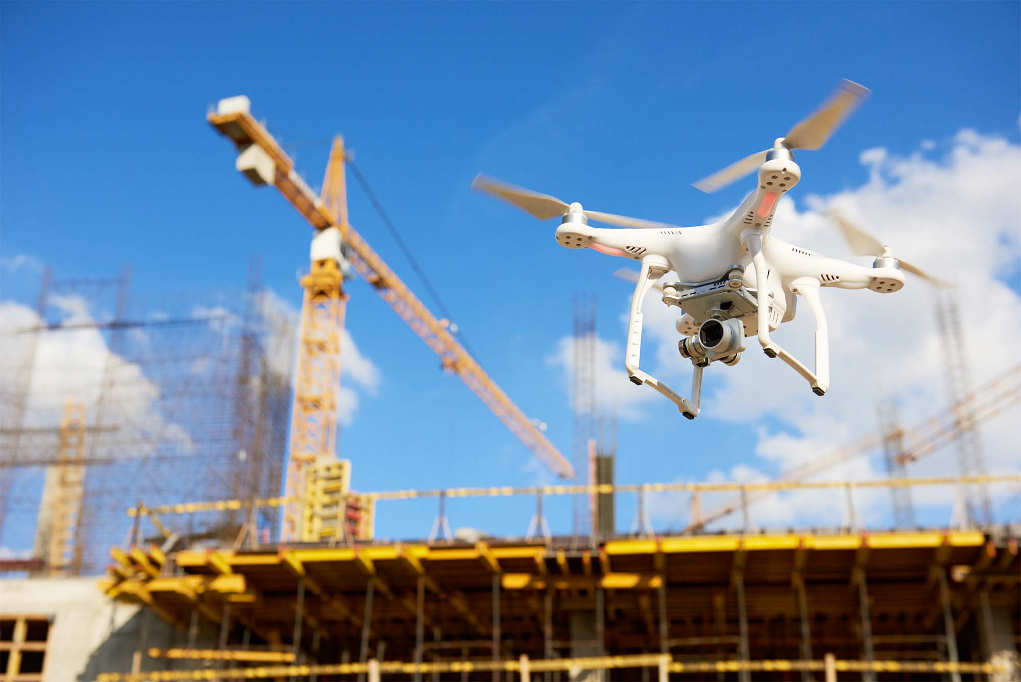
Most drone enthusiasts know that commercial operations are using drones in major industries like real estate, utilities, agriculture, and inspections. But even drone enthusiasts may not realize how much drone use is skyrocketing. Each day, drones are transforming work in technical and labor fields like construction and engineering. As technology becomes more accessible, the way professionals approach engineering tasks is rapidly changing. Technologies like 3D Modeling, laser scanning, and AI interfaces make engineering more efficient and more accurate than ever before.
The use of drones for engineering continues to accelerate, and today, one in 10 engineering companies worth $50 million or more use drones. In a report conducted by market analyst group Blue Research, 92 percent of 1,736 companies surveyed saw a positive return on drone investments within the first year of drone operation. This data suggests that US industries are increasingly adopting drone use, with a 35 percent increase in drone use for engineering industries. In addition, one in five survey respondents use drones or expect to use them soon. And 84 percent of companies anticipate an uptick in the overall number of drone flights to increase over the next year.
Why Do Engineers Use Drones?
Drones collect large amounts of data efficiently and safely, and they provide more accuracy than traditional surveying and monitoring equipment. Using drones for engineering also increases time and cost savings. And drones can gather data in hard-to-reach locations and rugged terrain easier than humans on foot or ground-based vehicles can.
One example is civil engineering firm Taylor Engineering, Inc., which works on water-related projects along the East coast. Typical projects involve coastal protection and restoration, dredging, and flood management. Staff Geologist William Warren initiated Taylor Engineering’s drone program in 2017, using a single Phantom 4 Pro to collect still images and monitor construction progress. The drone’s ability to use aerial mapping and wide-angle shots to assess change over time was impressive, and Taylor quickly accelerated its drone program. Today, Taylor Engineering has assembled a team of eight FAA-certified pilots, established a Remote Sensing Practice Area for training drone pilots, and regularly employs orthomosaic imaging to assess projects, track changes, create topographic maps, and monitor material stockpiles.
How are Drones Used in Engineering?
Engineering firms can use drones to perform inspections, monitor construction, conduct site surveys, and detect code violations. Drones can gather data and create detailed maps and 3D models for accurate, highly detailed reports. And drones for engineering can collect and analyze information faster and with less cost than human workers. Engineers can use drones for:
- Site Mapping
- Project Monitoring
- Mapping Topography
- Tracking Changes
- Inspecting Infrastructure
- Monitoring Job Site Safety
- Calculating Materials
- 3D Modeling
Site Mapping
Images, videos, and models are not standalone elements when using drones for roofing. Data must be analyzed and turned into understandable information. Drone roof inspection software, like the iRoofing and Drone Deploy apps, turn data sets into actionable insights and provide convenience and portability when paired with iPhones, Android phones, iPads, and other tablets. In addition, drone roof inspection software can provide specific measurements like length, pitch, and surface area. This information makes sharing, collaboration, and problem-solving faster and more comprehensive than using traditional methods.
After collecting and analyzing a complete set of roofing data, the software can provide a full report of the roof, roofing elements, and condition. A proper report contains images, videos, and AutoCAD files for integration into CAD software.
Aerial Photography
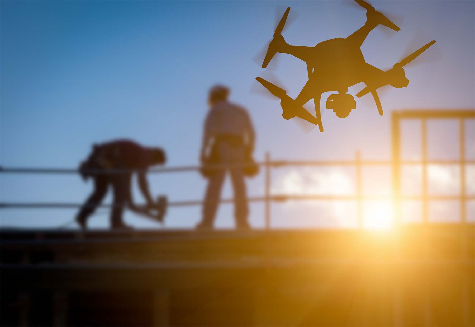
Drones use aerial imaging to capture sweeping panoramic views from towering vantage points, and the unique perspective of drone imagery dominates every market that could benefit from wide-angle imagery and video. Engineering uses this unique capability to document infrastructure and site changes before, during, and after project implementation. Aerial photography has become key for monitoring public structures such as utilities and inspecting towers, public works, and infrastructures like bridges and dams. And, drones’ aerial photography helps engineers identify potential hazards and document maintenance remotely, without the need for placing workers or costly equipment in potentially hazardous conditions.
Community Engagement
Drones provide a fun way to interact with the public using engaging imagery and videos for community websites and social media channels. Drone-powered visuals can help the public understand project purpose and functions, helping to build community engagement and boost support for local projects. For instance, descriptive animations may detail how a new traffic light could help relieve traffic congestion in high-traffic intersections and improve safety for community members. When the public perceives value in proposed projects, investors and community members alike understand why an improvement is worth investment.
Use Cases for Roofing
- Planning Stages
- Strategize Planning with 3D Mapping
- Detect Hotspots in a Building’s Structure
- Inspecting Structures
- Progress Tracking and Reporting
- Keeping the Project On Budget
- Virtual Design
- Warranties
- Showing Clients / Stakeholders Progress
- Surveying Job Sites
- Quickly Share Data with Sub-Contractors
- Compare Site Conditions with Plans
- Mapping a Job Site
- Efficiently Monitoring Multiple Job Sites
Benefits of Using Drones for Roofing
1. Accuracy up to 99 percent
Eliminate human error and obtain the data you need with up to 99% accuracy. By utilizing the capabilities drones have to offer, engineers will no longer have to return to a job site to gather missed information. Having accurate data on the first attempt results in exceeding project goals, producing value for clients, and saving time and money.
2. Decrease production time, increase company savings.
Time is money. By implementing drones, companies are obtaining worksite data faster than any other method. According to Sean McAllister, a surveyor, drones cut his surveying time for a 12-acre property from 100 hours down to 2. Drones are decreasing overall production time, leading companies to complete more projects in a shorter period of time. PwC estimates the current value of labor and services that may be replaced by drones is about $127.3 billion, a third of which comes from the infrastructure and construction industries.
3. Capture critical intelligence
Being able to capture site data to use for emergency planning and management purposes is critical. This is an area where using the quickly accessible aerial images collected by a sUAS are used to get a real time perspective on the exact status of a project site. Having access to this intelligence allows a team to easily track, communicate and manage site progress.
4. Win more bids
Offer lower costs and a faster workflow to your future clients. Prove a lower level of risk while conducting a job due to utilizing a sUAS while having the ability to gain critical information of hard to reach/dangerous areas. The client will be more inclined to sign with your company as opposed to a competitor as you will be able to not only sell the client fast results, but also sell aerial mapping and surveying services; making your company a one-stop-shop.
5. Make real-time decisions
Often times engineers don’t have access to consistent site visibility, resulting in inefficiency, project delays and lost clients. Drones can easily capture the most relevant information at every stage of the project. If a project issue arises such as a defect, leak, etc., launching a drone will allow the team to see where the issue is located and then assess in real-time; eliminating any added costs and delays.
Return on Investment in Using Drones for Engineering
Drone technologies and availability is building exponentially with each year. Tech companies are rapidly advancing drone hardware and software capabilities at lightning speed. With technology advances, demand for drones and drone programs has spiked. At the same time, availability and increased market demand have allowed for reduced cost, allowing engineering firms to onboard drone technology at a small price, especially when compared to short and long-term return on investment.
Drone platforms offer sweeping perspective and extreme accuracy, two points critical to the inspection or design of engineering projects. And drones for engineering perform without the need for multiple-person crews or bulky, expensive equipment that may have been necessary without a drone’s unique capabilities. This increased perspective and accuracy present significant cost savings on labor hours, repetitive field visits, specialized tools, vehicle refueling, and other equipment.
Modern drones produce high-definition imaging, video, and modeling to extend the reach and vision of engineering teams beyond anything possible just a decade ago. And drones provide this high-quality information at a fraction of the cost of traditional, human-powered methods. Sending a drone to survey hazardous areas such as quarries, towers, electrical lines, dams, and other dangerous structures or terrain means personnel can avoid facing such dangers.
According to OSHA, US employers collectively pay nearly $1 billion each week in expenses directly related to workers’ compensation claims. But employers pay for worker injuries in indirect costs as well, including:
- Training for employee replacement
- Accident investigations
- Corrective measures
- Researching and establishing new policies
- Loss of productivity
- Equipment and property repairs or replacement
Drones can provide a high ROI in worker safety alone. Taylor Engineering, Inc. helps protect employees and reduces costs related to work hazards by using drones to acquire LiDAR data in hazardous areas and inspect structures in areas affected by adverse conditions like flooding, high winds, and other natural hazards. Using drones for engineering projects, Taylor Engineering and other engineering companies can significantly decrease the frequency and severity of accidents, improving both profit and personnel safety.
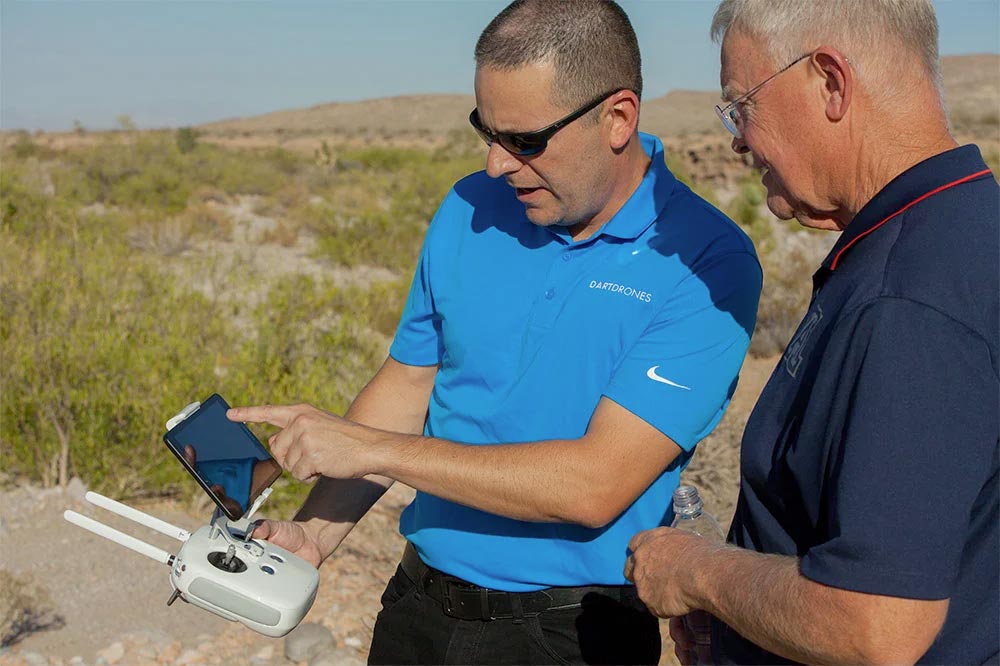
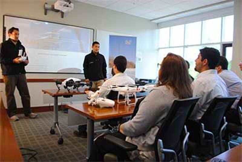
Drone Training for Engineering
If you’re new to the engineering industry or to drones, you’ll want the appropriate training prior to launching potentially pricey drone technology for your organization or client. Below is a list of training courses our experts recommend to those interested in breaking into the industry.
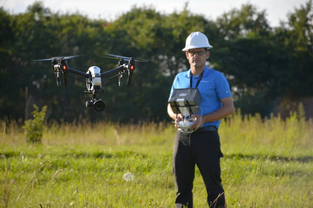
Basic Flight Training Course:
An excellent course for beginners or self-taught drone pilots. Master the fundamentals and principals of flying, autonomous flight, and how to fully utilize the settings and functions of your drone. This course is offered online, live/virtual, and in-person.
Part 107 Test Prep Course:
If you’re interested in operating a drone commercially, you’ll need to obtain your drone pilot license. The Federal Aviation Administration requires all individuals flying a drone for business, successfully pass this 60-question exam. This course ensures our students fully understand the complete concepts of aviation and are ready to ace their exam.
Aerial Drone Inspections Workshop:
Our Aerial Drone Inspections course is a two-day workshop with multiple flight sessions geared to developing the skills you need to fly, gather, and analyze aerial inspections data. Course prerequisites include 5 + hours of flight time and a Part 107 Certificate.
Relevant Regulations in Drones for Engineering
The rules for commercial drone use are ever-evolving, but the FAA Part 107 rule has made using drones for engineering more accessible than ever before. Today, regulations require only that commercial drone pilots register their drones, pass an FAA license exam, and complete a TSA background check.
In the Blue Research survey, 51 percent of company respondents said their company is “eager and excited” to use drones. However, others noted that employee approval for new drone programs within the company has been less enthusiastic. Some of this reticence may be a reaction to tightening regulations on drone use by the FAA, with 49 percent of the Blue Research study’s respondents citing “staying up to date on laws/regulations” as the number one obstacle to drone adoption. Creating processes that ensure adherence to FAA regulations was the second-place concern, cited by 43 percent of survey participants. Some of these regulations include:
- The 400-Feet Rule – Drone pilots must fly at or below a maximum of 400 feet altitude at all times. Commercial pilots, such as those flying drones for engineering, may fly 400 feet above structures and topographical elements, as long as the drone does not enter restricted airspace.
- Restricted Airspace – Drone pilots must avoid flying directly over public gatherings, such as sports events, concerts, and parades. Remote pilots must avoid flying through military airspace, near airports, in or above emergencies, near government buildings (without a special permit), or in crewed flight airspace.
- Privacy Protections – Remote pilots may not infringe upon the right to privacy of private citizens, meaning pilots may not fly drones near a person or persons or acquire direct images or video of a person without consent.
Commercial pilots, including those using drones for engineering, are responsible for knowing and upholding all rules and regulations of drone operation in the United States. Breaking these rules, even unwittingly, could result in fines, loss of certification, or even jail time. Therefore, it pays to know the rules inside out. If you need help learning or understanding the complete regulations for drone pilots, you may want to consider taking a course before beginning your career path as a drone pilot in any field.

Consultations
Drone service providers help relieve compliance concerns by connecting engineering companies and drone pilots with a network of experienced, FAA-certified drone pilots. Companies and individuals who are considering starting drone programs can protect themselves from legal risk by knowing rules and regulations inside out. If you are considering using drones for engineering, DARTdrones can help you get started.
Call 1+435-252-1238 or email DARTdrones to schedule your free consultation with an expert drone pilot today.
Starting a Drone Business for Engineering

As demand for drone pilots in engineering grows, more opportunities open up for people who want to build a business around drones for engineering. There are a few requirements for using drones for engineering, including a high-quality drone equipped with a full suite of scanning and modeling software capable of producing high-definition images and HD video.
Here are the necessities for starting a drone business in engineering:
- Drone-mounted HD camera
- Photogrammetry software
- LineVision software
- Geospatial software
The main challenge for drone pilots seeking a career in engineering is learning how to make the various software programs work together neatly and efficiently. And since new applications are being created, tested, and released regularly, keeping up with the latest technological advances ensures drone pilots can stay relevant in today’s ever-changing market. In today’s engineering industries, access to more data equals the ability to make better decisions, allowing pilots using drones for engineering to deliver better results to clients than ever before. And in the future, drones may become as essential to engineering as a smartphone is today.
Engineering Firms Using Drones
Engineers use drones because they improve efficiency, increase safety, and reduce the costs of various operations. Here are some of the most common uses for drones across engineering fields.
- Construction Engineers use drone data to analyze site improvements, track progress, and detect problems.
- Civil Engineers use drones to view high-risk projects like dams or highways and areas in rough terrain.
- Chemical Engineers fly drones inside equipment, small structures, or hazardous compounds to conduct visual inspections.
- Electrical Engineers use drones to inspect towers, pylons, grid stations, and other structures at heights dangerous or even inaccessible to humans.
If you’re looking for more resources or a place to start further research, here is a shortlist of some major companies using drones for engineering today:

About the Author
Jerry White is an experienced professional commercial aviator spending several years as a commercial corporate pilot, charter pilot, and airline pilot. Along with his manned aircraft experience, Jerry is also a drone pilot, and aviation executive team member. His background as a small business owner, business consultant, and aviation safety manager give Jerry unique understanding of the role of utilizing and teaching sUAS operations. Jerry’s experience as a manned flight instructor with over 6,000 flight hours awards Jerry valuable insight into teaching the complexities of aviation. Jerry also has an expansive background in television production, spending ten years as a professional news producer and videographer.
Jerry currently owns and operates an award-winning media production company in Austin, TX. He has used drones for such clients as the Discovery Channel, OWN network, ESPN, FOX, HGTV, commercials, and two feature films. Jerry has been instructing with DARTdrones since 2016 and teaches FAA Part 107 Test Prep, Basic Flight Training, Aerial Photography and Videography, TOP Level 1, and TOP Level 2. Jerry is versed in flying Inspire, Mavic, Phantom, and Flamewheel hardware and possesses an Unrestricted ATP (Airline Transport Pilot) Certificate – Multiengine, 2 Jet Type pilot ratings, and is a Certified Flight Instructor – Instrument.
WHY DARTDRONES? We have a proven track record for training pilots in dozens of industries.
INSTRUCTORS
Our instructors have manned aviation experience flying airplanes and helicopters and have gained the highest drone piloting recognitions in the industry. Many own successful UAS businesses themselves.
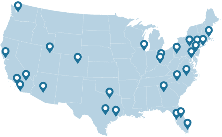
NATIONWIDE
As featured on ABC's Shark Tank, we are the nation's leading drone training company with an extensive network of alumni and partners throughout the country.
MATERIAL
Created and refined by UAS training experts, our curriculum is the best in the industry and has been tried and tested by clients in dozens of industries.
TRAINED
With a community of over 65,000 drone enthusiasts across the US and internationally, DARTdrones is at the forefront of UAS technology.
Expert Instructors
Our students absolutely love our instructors! Our classes are engaging, fun, and extremely informative.
Advanced Training Courses
We don’t just train our students on the basics. We have extensive advanced training courses to help our alumni succeed in mapping, inspections, disaster response, aerial photography, night operations, and search and rescue.
Industry Certified and Vetted Curriculum
Our curriculum has been vetted and certified by AUVSI, the leading UAS industry association, to ensure professional quality.

Learn More Today!