Learn to effectively gather, analyze, and export mapping data.
Develop the skills you need to fly drones for mapping missions in our Aerial Mapping and Modeling Live Virtual Workshop.
-
October 6 - October 162 weeks | Monday & Thursday Evenings
5:30 - 8:00 PM (Pacific Time)Live OnlineEnroll Now -
December 1 - December 112 weeks | Monday & Thursday Evenings
5:30 - 8:00 PM (Pacific Time)Live OnlineEnroll Now
Trusted by Top Organizations Across the Nation


Why does a new aerial mapper need this course? The ability to collect imagery that will be used for photogrammetric processing has become a critical skill for professional drone operators. The interactive orthomosaic products produced using photogrammetry provide tremendous amounts of actionable information, and companies that are hiring drone service providers expect them to understand the critical components of these datasets.
After submitting your independent hands-on Aerial Mapping and Modeling Projects, our instructor will review your data and present you with customized advice on how to improve.
A significant portion of the high paying contracts for drone services revolve around photogrammetry. There is a high likelihood that you will encounter a project that needs mapping.
This course focuses on autonomous profiles that are used for this comprehensive data capture methodology.
We also cover how to handle situations where autonomous profiles alone will not provide enough imagery to create a quality map or model, and semi-autonomous or manual flight techniques may also be necessary.
Our course teaches you the intricacies of identifying the critical components of image datasets that impact orthomosaic map and model quality.
Our course teaches you how to consider system capabilities, environmental factors, and client requirements to adapt your plan and capture excellent data sets.
Our course teaches you to ask the right questions so that you can land the job and deliver the high quality orthomosaics that will secure long-term clients.
"The best training ever."
This is one of many courses I have taken with DARTdrones. I will be back for more! The best training ever. Colin is a super instructor and willing to share information and keep the class moving and not waste time.
Curriculum Designed to Make You Successful
- Types of Mapping Data
- Types of Mapping Products
- Platform and Payload Considerations
- Mapping for Construction
- Mapping for Agricultural Uses
- Mapping for Engineering and Architecture
- Principles of Photogrammetry
- Photogrammetric Geometry
- Aerial Triangulation
- Photogrammetric Procedures
- Common Coverage Errors
- Georeferencing
- Spatial Reference Systems
- DroneDeploy Account Levels
- Autonomous Flight Planning
- Waypoints
- Collecting Nadir Imagery for 2D Mapping
- Collecting Oblique Imagery for 3D Modeling
- Orbit at End of Mission
- DJI Point of Interest
- Manual Collection
- Map Engine Processing Options
- Map Engine Data Requirements
- Uploading Datasets
- Accessing the Final Product
- Common Issues in Low Quality Maps
- Layers of a DroneDeploy Map
- Analyzing Evaluation Data
- Performing Volumetric Calculations
- Cut, Fill, and Volumetric Measurement Calculation
- Lowest Point and Best Fit Base Planes
- Adjusting Histogram to Change Elevation Values
- Relative vs. Absolute Accuracy
- Project Accuracy Requirements
- Survey-Grade Accuracy
- DroneDeploy Accuracy Levels
- Factors that Improve Map Accuracy
- Techniques to Improve Map Accuracy
- Creating GCPs
- Placing GCPs
- Utilizing the GCP Checklist
- Submitting GCPs in DroneDeploy
- Export Options in DroneDeploy
- Static Layer Export Procedures
- Custom Layer Export Procedures
- Sharing Your Map
- App Market for Enhanced DroneDeploy Capabilities
- Linear Mapping App
- Overlap Optimizer App
- PDF Annotation Report
- EZRoof App
- Quick Map Overlays App
- Tensor Flight App
- GCP Volume Analysis
- KML & SHP Import
- Thimble App
- AirData UAV Sync App
Independent “Hands-On” Aerial Mapping and Modeling Projects
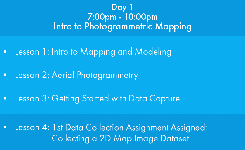
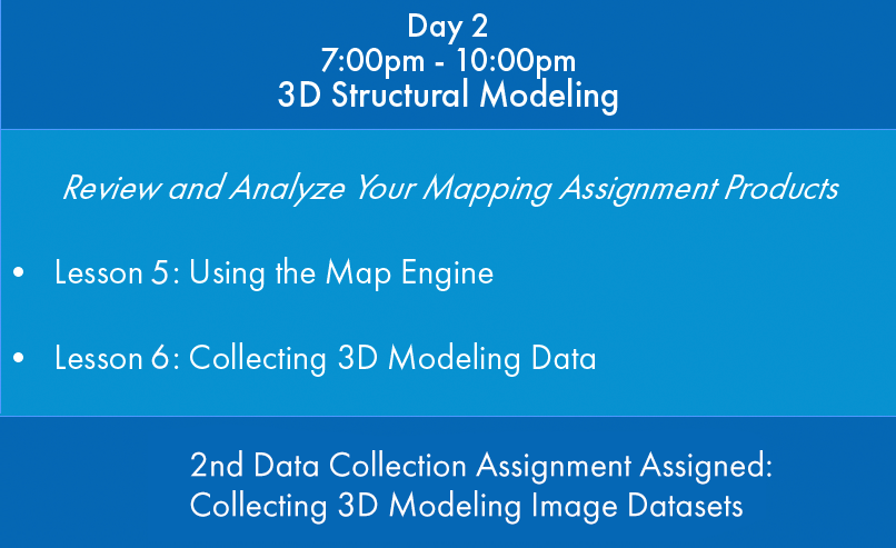
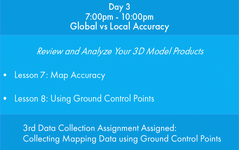
Students will be given both aerial mapping and structural modeling data collection assignments to gather with their sUAS and upload for processing between classes. The instructor will process the datasets of images gathered by each student and provide feedback on the orthomosaic products generated during the following virtual classroom session.
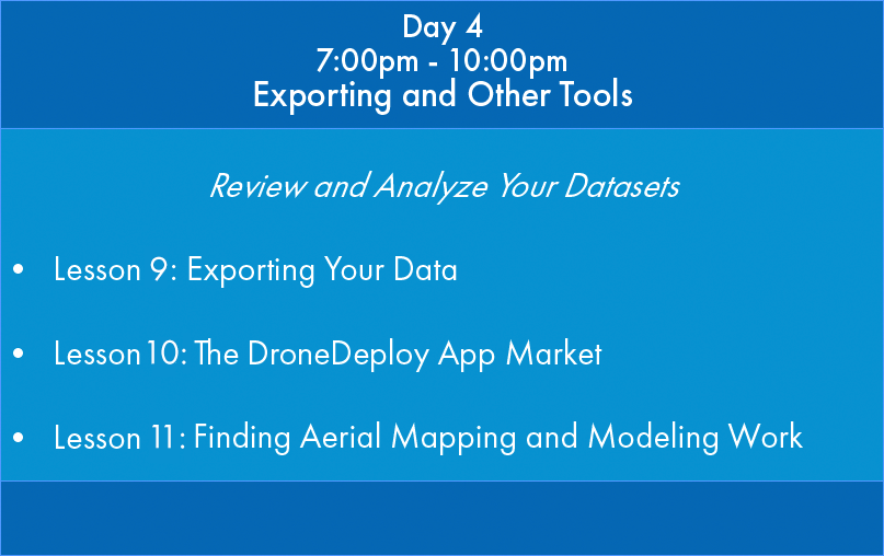
Schedule Overview
Prerequisites
To get the most out of this class, we recommend that you have:
DroneDeploy™ Compatible Drone
Your drone will need to be compatible with DroneDeploy™ software.
What You Get:
- 12 hours of live virtual training
- Virtual mapping data collection assignments
- Live analysis of data collected
- Live access to expert mapping instructor
- Recordings of the training
Upcoming Virtual Mapping and Modeling Dates
Aerial Mapping and Modeling Workshop
August 4, 7, 11,14
Aerial Mapping and Modeling Workshop
October 6, 9, 13,16
Aerial Mapping and Modeling Workshop
December 1, 4, 8, 11
Looking for a course near you? Reach out and let us know where our next course should be held.
Want to buy now and pick a time later? You can always purchase DARTdrones Training Credits for you or a loved one.
Our curriculum was designed by experts.
Learn from instructors with successful aerial mapping businesses.
Why complete the Virtual Mapping and Modeling Workshop with Dartdrones?
Learn the Art of Mapping
Having the ability to collect high quality data in any situation is not easy. Learn from those who have done it before.
Get More High Paying Jobs
Aerial mapping jobs are some the highest paying in the industry. Invest in differentiating yourself with a new highly specialized skill.
Be Confident in Your Skills
Confidently explain to potential clients whether a drone can accurately collect the data needed.
Live Access to Mapping Instructor
The training is live with one of our expert instructors. You can ask questions just like in a real classroom.
Comfort of Your Home
Complete comprehensive mapping and modeling training from the comfort of your home.
Save on Travel
Many students travel to our in-person training courses. Save on travel expenses by completing the course from home.
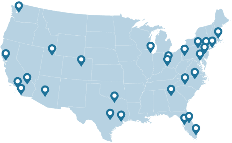
WHY DARTDRONES? We have a proven track record for training pilots in dozens of industries.
INSTRUCTORS
Our instructors have manned aviation experience flying airplanes and helicopters and have gained the highest drone piloting recognitions in the industry. Many own successful UAS businesses themselves.
NATIONWIDE
As featured on ABC's Shark Tank, we are the nation's leading drone training company with an extensive network of alumni and partners throughout the country.
MATERIAL
Created and refined by UAS training experts, our curriculum is the best in the industry and has been tried and tested by clients in dozens of industries.
TRAINED
With a community of over 65,000 drone enthusiasts across the US and internationally, DARTdrones is at the forefront of UAS technology.
Expert Instructors
Learn from our specialized team of instructors, comprised of manned pilots and drone business owners. Our classes are engaging, dynamic, and extremely informative.
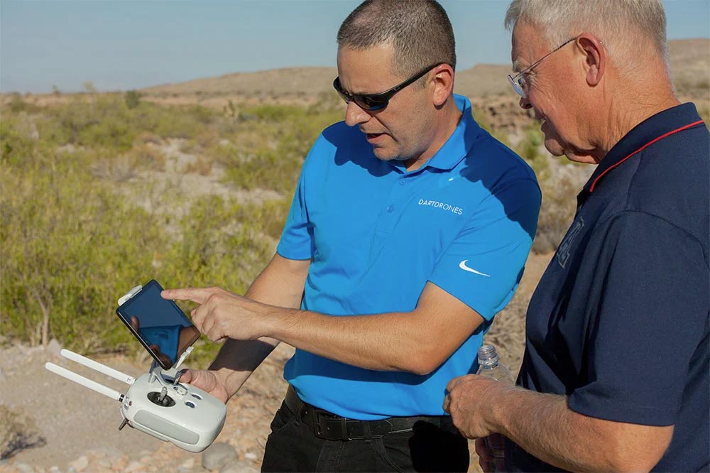
Advanced Training Courses
We don’t just train our students on the basics. We also offer extensive advanced training courses to help our alumni succeed in mapping, inspections, disaster response, aerial photography, night operations, search and rescue, and more.
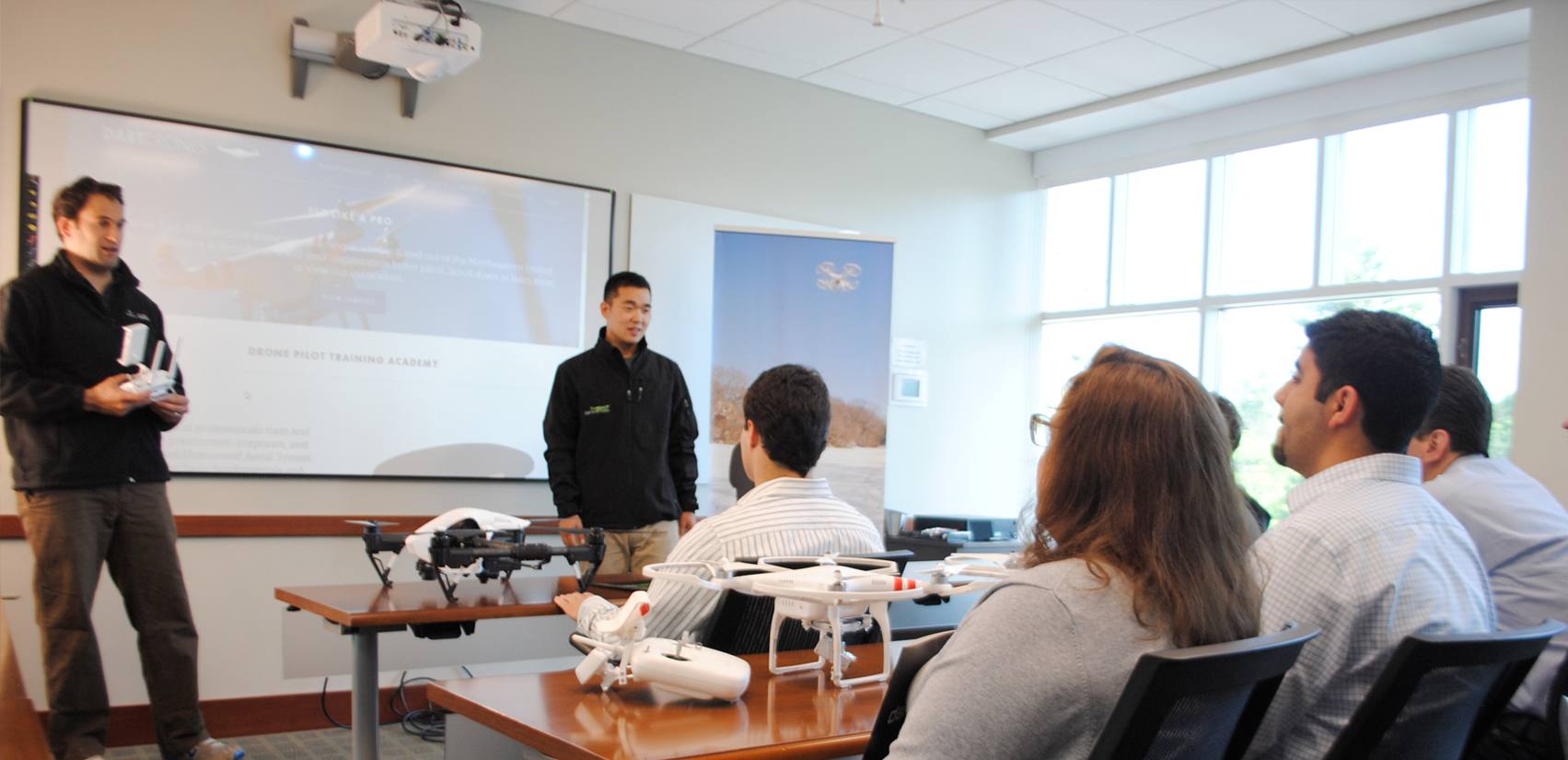
Curriculum Used for Real World Missions
DARTdrones has trained some of the largest drone programs in the country. Our curriculum is built based on training real drone pilots in the field every day.

FAQs
The Aerial Mapping and Modeling Live Virtual Workshop is an advanced training course. To attend the Workshop, we recommend students already understand how to fly a drone safely and to have already acquired a Part 107 Certificate. The class does not teach about how to fly a drone. If you have not flown before and have not passed the Part 107 exam, we recommend that you take our Drone Pilot Training course and/or Part 107 Test Prep course at least 4 weeks prior to attending the workshop.
Between course sessions, our instructors will assign you flights to complete before the next session. Although these flights aren’t required, you will get the most out of the class if you complete the flight sessions. We recommend a DJI Phantom 4 Series, DJI Mavic Series (except Mavic Mini and Air 2 models), DJI Inspire Series, DJI Matrice Series, Parrot Anafi, Skydio 2, Autel Evo Series, or Yuneec H520. Other models may be acceptable, but please contact our team before registering.
If you have an interest in getting aerial mapping jobs, the Aerial Mapping and Modeling Live Virtual Workshop is a great way to get started. The class covers specific information needed to understand to perform an aerial mapping mission. This course is designed to get you started. We will also point you in the right direction of companies hiring aerial mappers.
Yes! We do host this Workshop in-person. Learn more here: https://www.dartdrones.com/drone-mapping/
The Aerial Mapping and Modeling Live Virtual Workshop is great for individuals new to mapping as well as those with mapping experience looking to get into aerial mapping.
The Aerial Mapping and Modeling Live Virtual Workshop is an advanced training course. To attend the Workshop, we require students understand how to fly a drone safely and to have already acquired a Part 107 Certificate. The class does not teach about how to fly a drone. If you have not flown before and have not passed the Part 107 exam, we recommend that you take our Drone Pilot Training course and/or Part 107 Test Prep course at least 4 weeks prior to attending the Workshop.
Join our community of drone experts!
Subscribe to our newsletter to stay up to date with drone industry trends, events, and expert advice.
