How Drones Help After Storm Surveillance
Drones have many uses to which society can benefit from. Recently, with the increase in tornadoes in the middle of the country, UAV’s have a new purpose: to help after storm surveillance. Drone surveillance has been a hot topic amongst private property owners and local officials as issues about privacy and civil liberties have been raised. They are incredibly capable pieces of equipment, which can carry highly advanced surveillance tools such as:
- Live-feed video cameras
- Infrared cameras
- Heat sensors
- Radar
Drones are being used as data collection tools and also as a safer alternative as compared to having law enforcements going into an unknown territory where potential dangers could lie.
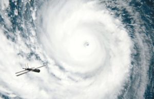
Drones help after storm surveillance by reaching areas humans would otherwise have trouble accessing, especially after a hard hitting storm. With the usage of drones, first responders are able to gain early access to these inflicted areas, without needing clear skies to fly and take pictures, like satellite imagery would need. Deploying a drone over a destroyed area, it is able to assess the damage quickly and easily at a fraction of the cost of using satellite imagery or deploying a helicopter. For example, when Haiti was struck with heavy rains from Hurricane Sandy, drones were the first responders. The Grey River in Port-Au-Prince, overflowed, causing the banks to rupture, causing widespread and immediate flooding. Houses were destroyed and destruction was left in its wake. To get an immediate analysis of damage and the extent of what it was, a drone was deployed and given a path. This path was set up with the help of the locals who lived there and knew the terrain the best. The assessment was made with a before-and-after comparison, to which they used previous satellite images to compare the drone images to. The drone images were able to be processed quickly only after four days after the entire flooding. To compare, the satellite imagery which was requested at the same time the drones were sent out, arrived one week after the drone images were processed.
The drones provided a precise and high resolution image to accompany the damage that had been done. The speed at which the drones were able to process these images, was incomparable to the traditional method of having to wait for satellite imagery. The quick response by the drones allowed local officials and humanitarians to learn about what areas had been hit hardest and what type of damage had been done. The fully encompassing aerial images provided in depth knowledge in a timely manner to help aid those who needed it quickly.
Situations like the one in Haiti demonstrates how the uses of drones can be used for good. As Kansas and other middle country states are being havocked my storms, drones will be an incredibly beneficial and revolutionary way to send in help. Drones are the quickest way to survey the damage and search for injured and missing people. Without having to put others in harm’s way, drones provide one of the safest resolutions to surveying and helping respond to disaster victims.
The implementation of drones into companies such as the American Red Cross will be a groundbreaking step towards the fastest response times yet resulting in people being rescued sooner and damaged areas being surveyed. These fast response times are unlike anything humanitarian efforts have seen before and the application of drones will truly make an incredible difference for future rescue missions. Drones and after storm surveillance is the future for first responders.

