Our ultimate package provides you everything you need to plan, launch, and scale a profitable drone business
Go from no experience to starting a commercial drone business with our Ultimate Starting a Drone Business Package.
- Learn to fly
- Earn your FAA drone license
- Master advanced mission-specific flights
- Learn how to start and run a drone business
The Ultimate Program for Launching a New Drone Business
The DARTdrones training and curriculum is designed to set you up for success whether that means becoming a part-time drone pilot in your free time, running a fully functioning business, or acquiring the qualifications to be hired full-time. Our training program features:
Flexible in-person training on the weekends
Online classes at your own pace
Live sessions with experts in the drone industry
"Gave me the confidence to pursue my dream of being a small-business owner"
DARTdrones offered me a great training foundation for my UAS piloting career. As a first-time flyer the hands-on experience of the training gave me the confidence to pursue my dream of being a small-business owner. The response to any and all questions that I had about the training reassured me that I was making a great choice in choosing DARTdrones for my training. And I passed my Part 107 training the first time, with ease.
Your guide to drone success:
Meet our San Diego instructor

Matt Bettencourt
Navy UAS Instructor PilotAviation Experience
13 yearsExpertise
B.S. in Systems Engineering from Naval AcademyPilot Rating
Commercial Pilot - Fixed and Rotary WingMatt is a contract UAS instructor pilot for the U.S. Navy as well as a helicopter pilot in the Navy Reserve. He has 13+ years of aviation experience and over 3,900 hours piloting military aircraft, including over 1,900 hours instructing on unmanned aircraft systems. Matt is currently the Navy’s lead Contract Instructor Pilot for the MQ-8 Fire Scout, the Navy’s first rotary wing UAS. He also instructs in the Navy’s MH-60S multi-mission helicopter. He has helped train over 900 students in both the MH-60S and MQ-8. He holds his Commercial Pilot Certificate with single engine airplane, rotorcraft, instrument and sUAS ratings. He is a graduate of the U.S. Naval Academy with a B.S. in Systems Engineering and a focus in robotics and computers.
8 best selling courses to help you successfully start your drone business
- Film, Photography, and Videography
- Infrastructure
- Inspections
- Emergency Services
- Mapping and Surveying
- Precision Agriculture
- Drones 101 Review
- Types of Drones
- DJI Overview
- Phantom / Inspire / Mavic Specs
- Standard DJI Systems
- Power System
- Propulsion and Maneuvering System
- Command and Control System
- Positioning and Navigation System
- Imaging Payload
- Downloading the App
- Connecting your Device
- Performing Firmware Updates
- System Status / Flight Mode
- GPS / Link Quality / Battery Level
- Camera Settings
- Map / Flight Telemetry Data
- Verifying System Settings and Status
- Performing a Compass Calibration
- Startup and Takeoff
- In-Flight Stick Commands
- Landing and Shutdown
- Flight Logging
- Multiple Flight Modes
- Beginner Mode
- Return to Home Altitude
- Maximum Flight Altitude
- Aerial Photography and Film
- Structural Inspection
- Aerial Mapping
- Loss of Control Link
- Fly Aways
- Disorientation
- Low Battery
- DJI GEO System
- Battery Management
- DJI Academy and Flight Simulator
- Flight Records
- Pilot In Command
- Registration Requirements
- Eligibility Requirements
- Conditions for Safe Operations
- Waiver Policy
- National Airspace System
- Air Traffic Control
- Clearances and Permissions
- Uncontrolled Airspace
- Controlled Airspace
- Restricted Areas
- Filing NOTAMS
- Special Use Airspace
- Military Training Routes
- VFR versus IFR Flight Rules
- Reading Sectional Charts
- Chart Legend
- Navigation Basics
- Chart Interpretation
- Difficult Chart Test Questions
- Operating Near an Airport
- Traffic Patterns
- Heliports
- Towered and Non-Towered Airports
- Runaway Markings and Signage
- Controlled Tower Communication Procedures
- Phonetic Alphabet
- Airport Terminal Information Service
- Self-Announce Procedures
- UNICOM/ MULTICOM
- Internet Weather Briefings
- Micrometeorology
- Reading METARS
- Stages of a Thunderstorm
- Types of Cloud Formations
- Scheduled Maintenance
- Unscheduled Maintenance
- Preflight Inspection
- Record Keeping
- FAA Inspection and Testing
- Requirements of Pilot In Command
- Situational Awareness
- Hazardous Attitudes
- Effective Communication
- Risk Management for Drone Pilots
- Basic Aerodynamics
- Aircraft Loading
- Weight and Balance
- Center of Gravity
- Reporting In-Flight Emergencies
- Fail Safe Procedures
- Airborne Inspections
- Wildlife Hazards
- Lithium Battery Hazards
- Impacts of Drugs and Alcohol
- Vision Impairments
- Determining Fitness for Flight
- Physiological Considerations
- Part 107 Regulations Requirements
- Registering for Airman Knowledge Test
- 300+ FAA Test Questions
- Best Study Practices
- Applying IACRA
- Applying for the Remote Pilot Certificate
- UAS Code of Conduct
- Remote Pilot Responsibilities
- Privacy
- Mitigating Risks
- FAA ‘Dirty Dozen’
- Communication
- Risk Management
- Hazard Identification
- Historical Data
- Risk Matrix
- Likelihood of Risk
- Severity of Risk
- Risk Mitigation
- Pilot Considerations
- Customer Expectations
Considerations
- Customizations
- Implementation
- Flight Planning
- Preflight
- Crew Briefing
- Flight Execution
- Emergency Procedures
- Post Flight
- Maintenance
- Hazard Identification
- Satellite Imagery
- Flight Planning
- Manmade Structures
- Terrain Variations
- Natural Obstructions
- Low-Level Turbulence
- Interference
- Forecast Sources
- METARs
- TAFs
- Visibility, Clouds
- Sky Condition
- Precipitation
- Wind
- Temperature
- Part 107 Requirements
- Go/No-Go Decision Making
- Airspace Classifications
- Controlled Airspace
- Uncontrolled Airspace
- Prohibited and Restricted Areas
- TFRs
- LAANC Authorizations
- Part 107 Requirements
- Roles
- Responsibilities
- Positioning
- Crew Management
- Crew Briefing
- Communication Methods
- Communication Procedures
- Aerodynamics
- Aircraft Axes
- Angle of Attack
- Turbulent Air
- Weight and Balance
- Prevention
- Disorientation Responses
- Practice Maneuvers
- Close Range Line of Sight
- Medium/Long Range Line of Sight
- First Person View
- Prevention
- Emergency Responses
- GPS Signal Loss
- Datalink Interference
- Compass Errors
- Flyaways
- Hardware and Software Failures
- Battery Issues
- Collisions
- Types of Communications
- CTAFs
- Scanners
- Transceivers
- Standard Format
- Common Conventions
- Traffic Patterns
- Aircraft Position
- Manufacturer Recommendations
- Preflight Inspections
- Post Flight Inspections
- Flight Logs
- Aircraft Logs
- Patterns of Wear and Tear
- Maintenance Protocols
- Battery Types
- Capacity
- Specifications
- Charge Cycle
- Discharging
- Maintenance
- Damage
- Disposal
- Storage
- Flight Regulations
- Registration Requirements
- Responsibility of Remote PIC
- Daylight Operations
- Hazardous Operations
- Crew Regulations
- Operating Limitations
- Types of Mapping Data
- Types of Mapping Products
- Platform and Payload Considerations
- Mapping for Construction
- Mapping for Agricultural Uses
- Mapping for Engineering and Architecture
- Principles of Photogrammetry
- Photogrammetric Geometry
- Aerial Triangulation
- Photogrammetric Procedures
- Common Coverage Errors
- Georeferencing
- Spatial Reference Systems
- DroneDeploy Account Levels
- Autonomous Flight Planning
- Waypoints
- Collecting Nadir Imagery for 2D Mapping
- Collecting Oblique Imagery for 3D Modeling
- Orbit at End of Mission
- DJI Point of Interest
- Manual Collection
- Map Engine Processing Options
- Map Engine Data Requirements
- Uploading Datasets
- Accessing the Final Product
- Common Issues in Low Quality Maps
- Layers of a DroneDeploy Map
- Analyzing Evaluation Data
- Performing Volumetric Calculations
- Cut, Fill, and Volumetric Measurement Calculation
- Lowest Point and Best Fit Base Planes
- Adjusting Histogram to Change Elevation Values
- Relative vs. Absolute Accuracy
- Project Accuracy Requirements
- Survey-Grade Accuracy
- DroneDeploy Accuracy Levels
- Factors that Improve Map Accuracy
- Techniques to Improve Map Accuracy
- Creating GCPs
- Placing GCPs
- Utilizing the GCP Checklist
- Submitting GCPs in DroneDeploy
- Export Options in DroneDeploy
- Static Layer Export Procedures
- Custom Layer Export Procedures
- Sharing Your Map
- App Market for Enhanced DroneDeploy Capabilities
- AirMap App
- Linear Mapping App
- Overlap Optimizer App
- PDF Annotation Report
- EZRoof App
- Quick Map Overlays App
- Tensor Flight App
- GCP Volume Analysis
- KML & SHP Import
- Thimble App
- AirData UAV Sync App
- Post natural disaster
- Scheduled commercial construction inspections and monitoring
- Insurance inspections
- Home and roof inspections
- Chimney and steeple inspections
- Utility inspections
- Water system inspections
- Solar farm inspections
- Wind farm inspections
- Railroad inspections
- Bridge inspections
- Getting Involved
- Platform Considerations
- Payload Considerations
- Types of Imagery Products
- Areas of Focus
- Manual Flight Profiles
- Common Manual Shots
- Determining the Shot List
- Sample Shot Lists
- Environmental Impacts
- Image Framing
- Common Camera Settings
- Specialty Camera Settings
- Flight Hazards Around Structures
- Common Drone Emergencies
- Recommended Emergency Responses
- Utilizing Preflight Checklists
- Determining Airspace Requirements
- Evaluating Forecast Weather
- Performing a Site Evaluation
- Verifying Waiver Requirements
- Checking State & Local Regulations
- On-Site Assessment Checklist
- Evaluating Current Weather
- Identifying Hazards
- Determining Takeoff/Landing Points
- Adjusting the Flight Profile
- Updating Lost Link Settings
- Determining Appropriate Crew Composition
- Camera Operator Responsibilities
- Visual Observer Responsibilities
- Visual Observer Placement
- Communication Methods
- Crew Briefing
- Fundamentals of Mapping & Modeling
- Mapping Software Overview
- Utilizing Mapping Software for Aerial Drone Inspections
- Thermal Imaging Fundamentals
- Types of Thermal Payloads
- Thermal Inspections
- What to Bring on a Job
- Sample Workflow
- Interacting with the Public
- Drone Job Resources
- Why Use Drones?
- Commercial Operations
- Equipment Options
- Pros and Cons of Inspire 1 & 2
- Pros and Cons of Phantom
- Pros and Cons of Mavic Pro 2 & Mavic Air
- Camera Options
- Lens Options
- Gimbal Balancing
- DJI GO Settings
- Photo Types
- Aspect Ratio
- Image Format
- White Balance
- Image Style
- Color Settings
- Foundations of Photography
- Shutter Speed
- Aperture
- ND Filters
- ISO Value
- Image Exposure
- Histograms
- Exposure Value
- Camera Modes
- Rule of Thirds
- Fundamental Shots
- Drone Shots
- Camera Angles
- Video Size
- Frame Rate
- Video Format
- Video Standards
- Color Settings
- Controller Settings
- Gimbal Tuning
- Aircraft Response Settings
- Rise and Reveal
- Descending Approach
- Rising Retreat
- Tracking Shot
- Orbit Shot
- Panning Shot
- Tilt Shot
- Fly By Shot
- Sliding Shot
- Flyover Shot
- Bird’s Eye View
- Fly Through Shot
- Jib Shot
- Stationary Shot
- Expert Tips
- Post Production Basics
- Software Options
- Editing Tools
- Drone Market Analysis
- Personal Fit
- Competitive Analysis
- Identifying a Target Market
- Target Market Pros and Cons
- Service Offerings
- Pricing Strategy
- Branding
- Choosing a Company Name
- Designing a Logo
- Developing a Tagline
- Digital Marketing
- Content Marketing
- Search Engine Marketing
- Pay Per Click Strategy
- Creating Your First AdWords Campaign
- Display Ads
- Search Engine Optimization
- Identifying Keywords
- SEO Best Practices and Strategy
- Social Media Marketing
- Creating a Facebook Ad
- Advertising in Newspapers and Magazines
- Public Relations Strategy
- Building to Scale
- Establishing Your Website
- Website Hosting
- Web Development Tools
- External Phone System
- Setting Up Business Emails
- Hiring Strategically
- Developing a Org Chart
- CRM Systems
- Project Management Systems
- Tools for Internal Communication
- Liability for Drone Pilots
- Types of Business Organizations
- Sole Proprietorships
- Partnerships
- Limited Liability Companies
- Employment Contracts
- Copyright Law
- Trademarks
- Privacy Considerations
- UAV Insurance
- Insurance vs. Warranty
- How Much Insurance Coverage Do You Need?
- Why Buy Drone Insurance?
- Factors Affecting Coverage
- Best Practices
- Insurance Options
- Warranties
- Risk Mitigation
- How to Prepare for Disaster Response Missions
- Understanding Weather
- Manmade Hazards
- Travel Preparations
- Equipment and Backups
- Communicating with Incident Command
- Personal Health and Safety
- UAV Pilot Safety Tips
- Type and magnitude of a disaster
- Emergency management efforts
- Phases of the emergency response process
- Roles of local, state, and federal governments
- Process for disaster declaration
- Structure of incident command system
- Effective UAV utilization for each phase
- Types of Disasters
- Sudden Events and Expected Events
- First Hours on Scene
- UAS Pilot Response
- Case Study: Hurricane Irma
- A Helicopter’s Perspective
- Importance of Communication
- Pre-Disaster Applications
- Disaster Response Applications
- Recovery Applications
- Earthquakes
- Fires
- Floods
- Manmade Disasters
- Hurricanes
- Weather Events
- Assistance in Emergencies and Disasters
- Training to Build Capabilities
- Preparation Plan
- Real-World Disaster Response UAV Operations
- Case Study: Mapping for Inspections Following Hurricane Irma
- Case Study: Search and Rescue Operations During Hurricane Matthew
- Lessons Learned and Key Takeaways
- Advantages and Disadvantages of Multi-Rotor Aircraft
- Advantages and Disadvantages of Fixed Wing Aircraft
- Advantages and Disadvantages of Helicopters
- Advantages and Disadvantages of Hybrid Aircraft
- EO Sensors
- FLIR Sensors
- Chemical Detectors
- Other Payloads
- Volunteering to Build Skills
- Building Relationships
- Volunteering for County and State Agencies
- Volunteering Internationally
- Best Practices while Volunteering
- Requirements for Contracting with FEMA
- Finding Contracts Based on Emergency Management Phase
- Other Organizations involved in Disaster Response Efforts
- Importance of NIMS Training
- Useful Waivers during Disaster Response
- How to Work with Agencies, Organizations, and Corporations
- Coordinating with Incident Command
- Checking-In at an Incident
- Incident Supervisor and Initial Briefing
- Incident Command Post
- Check-out and Demobilization
- FAA TFR Memo after Hurricane Irma
- FEMA’s Remote PIC Position ICS Training Requirements
- Data Requirements Impact on Flight Profiles and Altitude
- Organization Data Privacy and Security Policies
- Flight Profiles
- FAA Weather Minimums
- Weather Assessment
- Sources of Weather Information
- Site Assessment
- Hazards and Conditions Unique to Emergency and Disaster Areas
- Roles and Responsibilities of Crew Members
- Crew Management
- Stressors
- Ways to Prevent Stress among Crew Members
What You Get
- 2 days of hands-on in-person training
- 50+ hours of online and virtual training
- Advanced training on mapping, inspections, night operations, disaster response, and aerial photography
- Access to a proven program for drone entrepreneurs
Select a weekend that works for you in
Want to buy now and pick a time later? You can always purchase DARTdrones Training Credits for you or a loved one.
Curriculum designed by drone experts to make you successful.
You’ll walk away with the skills you need to start your own drone business.
Why Complete the Ultimate Starting a Drone Business Package?
Perfect for all level of pilots
This training program is designed to aid you in launching your own drone business, even if you have no previous experience with drones.
Learn from successful drone entrepreneurs
Learn and network with our instructors, many accomplished drone business owners. Visit our about us page to learn more.
Fly advanced missions
Drone pilots and business owners are more lucrative when able to execute mapping and industrial inspections missions.
Proven program
We've trained hundreds of drone entrepreneurs. Our unique program is proven to work.
Comprehensive training
The Starting a Drone Business Package equips you with everything you need to successfully launch in the drone industry.
Access to our extensive alumni network
We have thousands of alumni across the country and train some of the largest organizations in the world. Learn from and connect with the DARTdrones network.
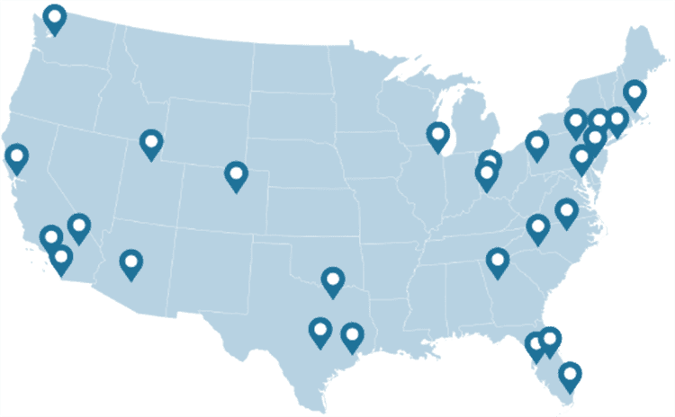
WHY DARTDRONES? We have a proven track record for training pilots in dozens of industries.
INSTRUCTORS
Our instructors have manned aviation experience flying airplanes and helicopters and have gained the highest drone piloting recognitions in the industry. Many own successful UAS businesses themselves.
NATIONWIDE
As featured on ABC's Shark Tank, we are the nation's leading drone training company with an extensive network of alumni and partners throughout the country.
MATERIAL
Created and refined by UAS training experts, our curriculum is the best in the industry and has been tried and tested by clients in dozens of industries.
TRAINED
With a community of over 65,000 drone enthusiasts across the US and internationally, DARTdrones is at the forefront of UAS technology.
Expert Instructors
Learn from our specialized team of instructors, comprised of manned pilots and drone business owners. Our classes are engaging, dynamic, and extremely informative.
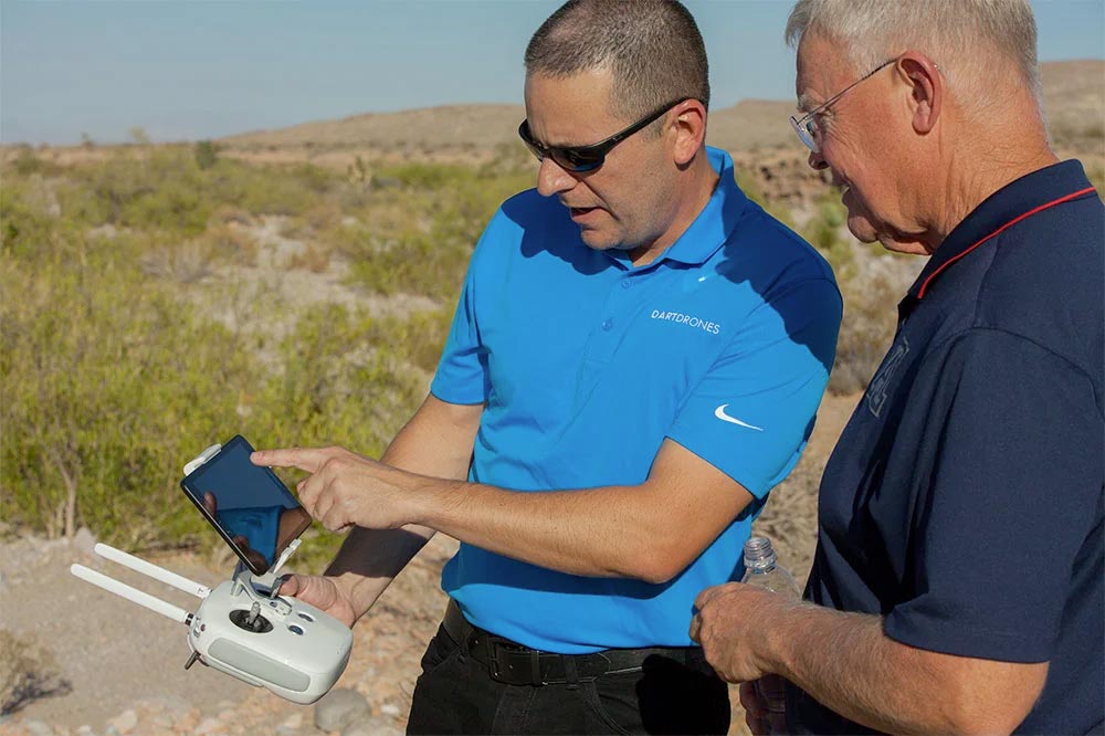
Advanced Training Courses
We don’t just train our students on the basics. We also offer extensive advanced training courses to help our alumni succeed in mapping, inspections, disaster response, aerial photography, night operations, search and rescue, and more.
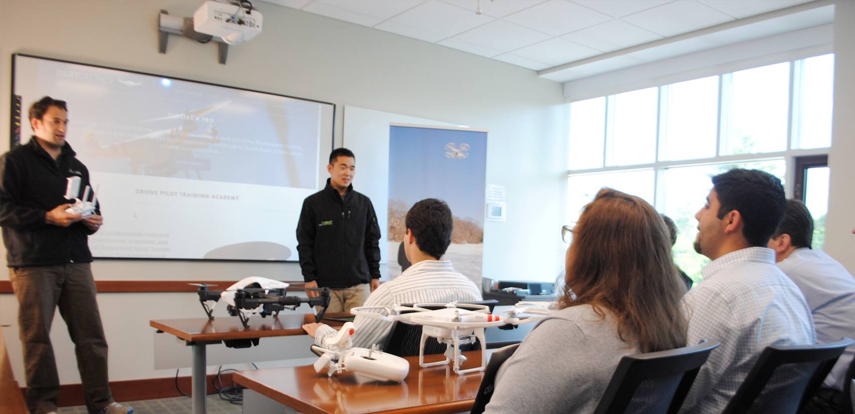
Curriculum Used for Real World Missions
DARTdrones has trained some of the largest drone programs in the country. Our curriculum is built based on training real drone pilots in the field every day.

FAQs
We’re not going to sugar-coat this: starting a drone business takes time, energy, and motivation, but this effort is going to lead to you building something real and rewarding. The good news is that by researching training, you’re already taking the first steps toward achieving your goals and making money doing what you love.
DARTdrones is committed to supporting you and helping you succeed. The Starting a Drone Business Package, including the connected Drone Entrepreneur Webinars and alumni benefits, are designed to make the process transparent and give you the tools you need. Call our Enrollment Specialists at 1-800-264-3907 to talk about the package in more detail.
DARTdrones wants its trainees to achieve their goals and be as successful as possible. We work diligently to provide the tools you need to take advantage of the tremendous opportunities in the drone industry, both when you are a student and as an alumnus. When we ask our alumni about success and ROI, they tell us that ROI timelines depended on their motivation and diligence in applying course recommendations. Because the drone industry has grown so much in the past several years, there are many lucrative opportunities for drone contractors to sell UAS services.
Our instructor provides a drone in the course, typically a DJI Phantom Series sUAS. For insurance and liability purposes, students CANNOT fly their own equipment during the course unless they provide proof of liability insurance with DARTdrones LLC named as an additional insured prior to the course. Although our class covers the Mavic and Inspire, our instructors usually only have a Phantom which is sufficient for this level of training.
Any insurance company that offers coverage for sUAS flight is sufficient for this course. Many students have used Verifly as their provider. Verifly is available in most states and allows for coverage to be purchased by the hour.
Yes! The Drone Pilot Training course rotates from indoor to outdoor training. Learn in the comfort of a classroom and then head outside to fly in 3 one hour flight sessions. The Part 107 Test Prep course is completely inside.
Although the specifics of marketing your business and finding clients will be different for each entrepreneur and the industries you plan to target, the Starting a Drone Business online class provides specific recommendations for networking and marketing.
In August of 2016, the FAA launched new rules for commercial drone pilots under the FAA regulations called Part 107. The new rules allow people interested in flying their drones for profit or commercial use to gain a license from the FAA to fly their drone for commercial purposes after passing a 60 question, two hour exam offered at an FAA testing center. (The old rules used to require a 333 exemption and a manned aircraft pilot’s license. This is no longer necessary.) Someone new to aviation could commit 15-20 hours of study time and be ready to pass their exam. The cost to take the exam is $150, paid to the testing center. DARTdrones does not offer locations to take the exam, but it’s really easy to book it at one of the FAA’s 690 testing centers across the country. Once you pass the exam, you get your certificate within a few weeks and are able to fly commercially.
Although we cover all of the content that you will need to study for the test, many students want to spend study time with our online Part 107 Test Prep course, especially the practice tests. We recommend not booking your exam until after you complete our class and feel ready.
We keep our courses small and limit the Drone Pilot Training course to eight students and the Part 107 In-Person Training to about 10 students.
Join our community of drone experts!
Subscribe to our newsletter to stay up to date with drone industry trends, events, and expert advice.
