UAS for Public Safety: Hurricane Matthew Search and Rescue, Damage Assessment, and Structural Inspection

Mike Uleski, an active Sergeant with a Florida public safety department, launched his department’s UAS unit to aid in Hurricane Matthew disaster relief. Mike is cross trained as a law enforcement officer, firefighter, and EMT. He has a degree in Aeronautical Sciences from Embry-Riddle, a commercial pilot certificate with single-engine, multi-engine and instrument ratings, and 17 years of experience building and flying remote controlled aircraft. He also serves as the Chief Public Safety Flight Instructor at DARTdrones, a national UAS training organization.
Throughout this case study, you will learn how Unmanned Aircraft Systems (UAS) in public safety have the capability of offering significant efficiency advances compared to traditional search and rescue, damage assessment, and structural inspection operations. DARTdrones is excited to share Sergeant Mike Uleski’s story demonstrating this industry-altering technology.
The Problem
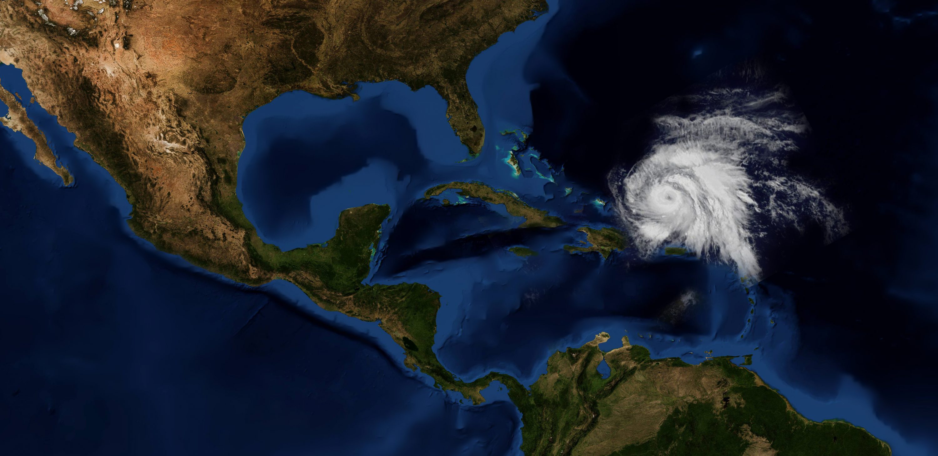
In October 2016, the east coast of Florida saw the first approach of a powerful and devastating tropical cyclone which became the first major hurricane in the area since Hurricane Felix in 2007. Hurricane Matthew was forecasted to strike the Florida Peninsula as a Category Four storm but actually arrived as Category Five. The storm’s highest winds reached 165 mph and damages were estimated to be over $15 billion.
While Mike Uleski attended his agency’s operational briefing regarding all plans for before, during, and after the hurricane, he was tasked with flying the department’s UAS unit for post-storm search and rescue, damage assessment, and structural inspections. “I received permission and I quickly began planning and mobilizing for launch,” said Uleski.
All registered UAS pilots received an email prior to the hurricane regarding flying in areas affected by the storm. Abiding by all FAA rules, regulations, and Temporary Flight Restrictions (TFR), Mike contacted the air traffic control (ATC) for Daytona Beach International Airport, class C airspace. He received airspace authorization as needed and was required to contact ATC prior to takeoff and notify them once UAS operations were completed.
The Solution
An Unmanned Aerial System was launched immediately after the hurricane passed and winds subsided to perform initial hazard and damage assessments. Mike acted as the Pilot-In-Command and was assigned a Visual Observer for all hurricane flight operations. The aerial perspective was critical for these initial assessments in order to scout areas of heavy damage where ground vehicles had difficulty maneuvering due to downed trees and power lines.
Damage assessment and aerial inspection flights were deployed after initial hazard and damage assessment flights concluded. The drone being used, a DJI Phantom 3 Advanced, was able to properly perform, even with wind gusts up to 30kts. A 5-block area was able to be assessed with a single battery. Each building was surveyed with the UAV, and areas of observed damage were noted on a map for later detailed inspection and analysis.
Due to the amount of damaged property, multiple UAV flights were necessary. The operational area was approximately seven miles long, and a half mile wide. The initial assessment and survey flights required roughly two hours of flight time. All other damage assessment and inspections required six hours of flight time. Total flight time and execution was eight hours.
The Results
Using a drone to inspect and assess hurricane damage allowed UAS pilots to collect data much faster than traditional public safety methods. The aerial photographs and videos collected during these missions were quickly captured, downloaded, and delivered to the city public works department before beginning hazard clearing. The local power company used the information for analysis of the integrity of the power grid, and the building department used it for building inspections. The area’s finance department also used the data for documentation for FEMA reimbursements. With this detailed UAV data, the city was able to quickly and efficiently evaluate damage and correctly prioritize clean up.
During large scale events, such as Hurricane Matthew, it is important to understand the National Incident Management System (NIMS). Any large-scale events will involve an incident command structure. An UAS can provide important intelligence to the incident commander, but also interfere with recovery operations if not included in the incident operational planning. Free online classes are available for introductory courses, ICS 100, 200, 700, and 800, through FEMA. It is highly recommended for any UAS operator, volunteer or public safety professional, to have these certifications and a working knowledge of how to integrate it into the incident command structure prior to responding to a public safety incident.
Overall, these flights demonstrated significant cost and time savings. More UAS pilots will respond to future natural disasters and major events to assist in assessment, relief, and recovery. UAS training and technology has already been credited with saving lives, and the number of rescue missions will surely increase. But as the technology is very new to public safety, it is important to always operate in a safe manner and learn from other department’s successes, as well as their failures.
UAS After Action Report
- Date: October 8 – 9, 2016
- Event: Hurricane Matthew, Daytona Beach Shores, FL
- Mission: Initial search and rescue, area hazard and damage assessment, structural inspection
- Aircraft: DJI Phantom 3 Advanced
- Flight crew: One Pilot-In-Command/One Visual Observer
- Total number of flights: 30
- Total flight time: 8 hours
- Total distance flown: 36 miles
- Maximum altitude: 150 feet AGL
- Weather: Temp 85 degrees F, sky clear with unlimited visibility. Wind from the southwest at 20kts., gusting to 27kts.
About DARTdrones
We are the national leader in UAS training and UAS consulting. We offer in-person and online Part 107 test prep and commercial drone training programs. If your department is interested in implementing drones into daily operations, call us about our custom public safety drone training. Check out www.dartdrones.com or call 800.264.3907 to learn more information!